Progress
Ras Malé's Environmental Impact: Sediment, Reefs and Bait Fishing
Reclaiming a thousand hectares of lagoon changes the sea around it. Here is what has been reported about Ras Malé's effects on reefs, water quality and fishing, what's been done to limit them, and why the government calls it a climate adaptation project.
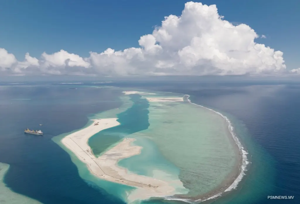
Ras Malé is being built by filling most of a 1,153-hectare lagoon with sand dredged from elsewhere in the atoll. A project on that scale inevitably changes the sea around it: the lagoon itself, the areas where sand is taken, and the reefs and fishing grounds nearby. The government argues the trade-off is worth it, because the Maldives urgently needs high, safe land. This article sets out what has been reported on both sides. Wherever we can, we link to the original reporting.
In short ⌄
- In early 2026, satellite images showed sediment plumes from the Ras Malé and Hulhumalé dredging covering large parts of South Malé Atoll.
- Dive operators reported murkier water at well-known sites, and bait fishermen asked the government to stop taking sand from key fishing grounds.
- Before dredging, 21,641 corals were moved to propagation sites. The regulator has received complaints about dredging outside permitted areas.
- The government presents Ras Malé as climate adaptation: new land raised 2 to 3 metres above sea level, in one of the lowest-lying countries in the world.
The lagoon and the sand
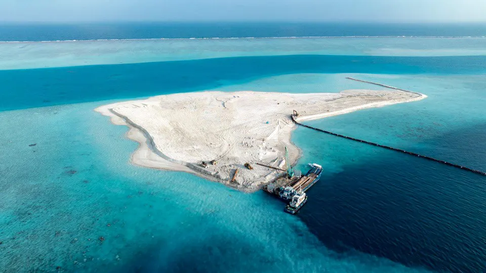
Reclamation turns lagoon into land. Of Fushidhiggaru lagoon's roughly 1,153 hectares, about 1,009 hectares are to become land, according to the government. Whatever lived on that lagoon floor is buried.
The sand comes from borrow areas, permitted zones of seabed where dredgers dig. The Environment Protection Agency issued six-month permits for dredging and sand collection from two areas west of Maafushi in Kaafu Atoll and a third near Ithaafushi resort, enough to reclaim 562 hectares. Taking sand changes the depth and shape of the seabed in those areas. Fishermen and activists say that matters for the small fish that live there.
Sediment plumes
Dredging stirs up fine sediment, which drifts with the currents as a cloudy plume. In February 2026, the Maldives Independent reported that Sentinel-2 satellite images from January showed plumes covering large parts of South Malé Atoll. It traced them to the dredgers working on Ras Malé and on Hulhumalé's expansion.
Sediment matters because corals need clear water and light. When it settles on reefs, it can smother corals and stop new ones from settling. Scientists have also warned that local stresses like dredging can make bleaching from marine heatwaves worse. The same report noted that the regulator's own coral restoration project at Rasfari, a separate lagoon, lost most of its planted corals in a bleaching event the year before.
Dive sites and tourism
The reefs around Greater Malé are popular with divers, and many resorts and guesthouses depend on them. Dive operators told the Maldives Independent that a popular site near Hulhumalé known as the "shark tank" had become murky, and that noise from dredgers had reduced shark sightings. One said several companies had stopped diving there. Kurumba's house reef and Banana Reef were also reported to be in poor condition. These are first-hand accounts from operators. We haven't found a published scientific survey of the sites.
Bait fishing
The Maldives' pole-and-line tuna fishery depends on live bait, small fish caught in lagoons and on reefs inside the atolls. Fishermen told the Maldives Independent that reclamation had damaged the inner-atoll bait fishery. The fishermen's union, Bodu Kanneli Masveringe Union, asked the government to stop taking sand from key bait-fishing grounds. An activist said sand removal changes lagoon depths and makes them unsuitable for bait fish. The union wrote to the Environmental Regulation Authority. At the time of reporting, it hadn't received a reply.
What's been done to limit the damage
- Coral relocation. Before new sites were dredged, 21,641 corals were removed from the affected areas. They were moved to coral propagation programmes at Benhaa Faru and Maniyafushi in Malé Atoll, and to several resorts. HDC also began relocating corals from Sites A, B, H, I and K before dredging there. We haven't found published figures on how many of the moved corals have survived.
- Permits. Dredging is only allowed in permitted borrow areas, for limited periods.
- Enforcement. In December 2025, the Environmental Regulation Authority said it had received complaints about dredging outside permitted zones and during sand-mining alerts. It warned of legal action, without naming anyone. We haven't seen any action reported since.
- The waterfront district. Eagle Hills has said its Ras Malé project will involve no further dredging, and that independent marine monitoring will accompany construction.
We haven't found a public copy of the environmental impact assessment for the Ras Malé reclamation. If one is published, we'll link to it here.
How the concerns have built up
- December 2023: reclamation of Fushidhiggaru lagoon is launched.
- 2024: the Environment Protection Agency permits borrow areas west of Maafushi and near Ithaafushi.
- 2025: 21,641 corals are moved ahead of dredging at new sites, and much larger dredgers arrive in August and December.
- December 2025: the Environmental Regulation Authority reports complaints about dredging outside permitted zones.
- January–February 2026: satellite images show sediment plumes across large parts of South Malé Atoll. Dive operators and the fishermen's union raise concerns.
- September 2026: Eagle Hills says its waterfront will need no further dredging and will have independent marine monitoring.
The concerns grew as the pace of dredging picked up. The same big dredgers that made the fast progress of 2026 possible also moved far more sand, much more quickly.
Not the first reclamation near Malé
Greater Malé has been reshaped by reclamation for decades. Hulhumalé was built on reclaimed land from 1997. Thilafushi, west of Malé, was created from a lagoon after a 1991 government decision and became the capital's landfill island. Gulhifalhu, between Villimalé and Thilafushi, had its lagoon filled in a project that finished in July 2024. Each project added land the capital badly needed, and each changed the reefs and lagoons around it. Ras Malé is larger than all of them. That's why its effects on South Malé Atoll are being watched closely by divers, fishermen and environmental groups.
The climate case
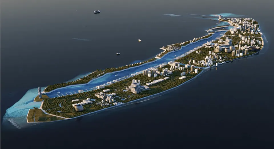
The government's argument is that Ras Malé is itself an environmental project. The Maldives is one of the lowest-lying countries on earth. Only about 0.3% of its surface is dry land, and more than 40% of the population lives in Malé. At the launch, the government said Ras Malé would be raised 2 metres above sea level at its edges and 3 metres at its centre, giving families safer, higher ground. The President's Office has described the reclamation as the country's largest climate adaptation project.
The city is also planned as an eco-city. The plans at the launch included running it entirely on renewable energy, with electric and battery-powered vehicles. Those plans haven't yet been set out in detail.
Critics quoted in local reporting have focused on the damage to reefs, dive sites and bait grounds. They have also pointed out that about 500 hectares of the new land is going to a waterfront and marina development rather than housing.
What to watch
- Publication of the environmental impact assessment and any monitoring reports.
- Whether the regulator acts on the complaints about dredging outside permitted zones.
- The condition of nearby dive sites and bait grounds once dredging stops, expected after the end of 2026.
- Details of the renewable energy and transport plans for the new city.
For the work itself, see Ras Malé site by site and the dredgers building Ras Malé.
Questions people ask
Is Ras Malé bad for the environment? ⌄
What happened to the corals at Ras Malé? ⌄
Where does the sand for Ras Malé come from? ⌄
Sources
- President champions climate adaptation abroad as dredgers blanket atoll in sediment · Maldives Independent, 2026-02-12
- EPA permits dredging of two areas for land reclamation of Rasmale' · PSM News
- China's CHEC joins Ras Malé reclamation as government expands contractor base and deploys mega-dredger · PSM News, 2025-08
- HDC begins coral relocation to dredge more areas for Rasmale' project · PSM News
- Rasmale' land reclamation reaches 30% completion, MACL says · MV+, 2025-12-24
- Eagle Hills signs $12 billion Maldives waterfront deal · Gulf News, 2026-09-21
- President Muizzu launches Maldives' largest-ever land reclamation project 'Ras Malé' · MV Republic, 2023-12-18
- Foreign money, not foreign neighbours: Rasmalé and the politics of land · Maldives Independent, 2026-10-01
- President inspects progress of Rasmalé Land Reclamation Project · The President's Office, 2025-11-12
- Rasmale (Maldives Eco City) project page · Housing Development Corporation
- Thilafushi · Wikipedia
- Gulhifalhu · Wikipedia
- Hulhumalé · Wikipedia